Partner opportunities available for jurisdictions and organizations. Visit the FAQ to learn more.

Wildfires move fast. Sentinel helps you stay ahead.

Are any fires a threat to me or my loved ones right now? With location-based notifications, fire spread forecasts, and real-time fire incident updates, Sentinel helps you answer the questions that matter most. Free for everyone. Search "Sentinel by Ladris" to download today.

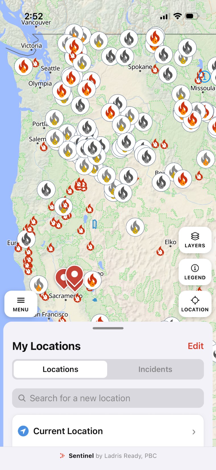
Sentinel map of active wildfire incidents across the western United States
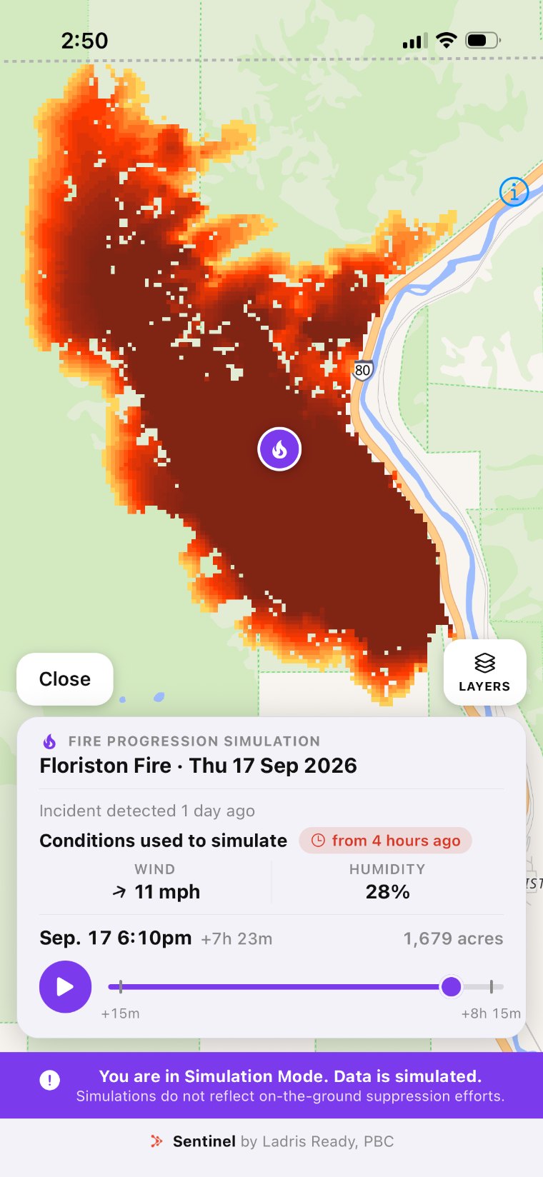
Sentinel fire progression simulation for the Floriston Fire showing predicted spread along I-80

Preparedness made simple.

The information you need to answer the questions that matter, all in one place.

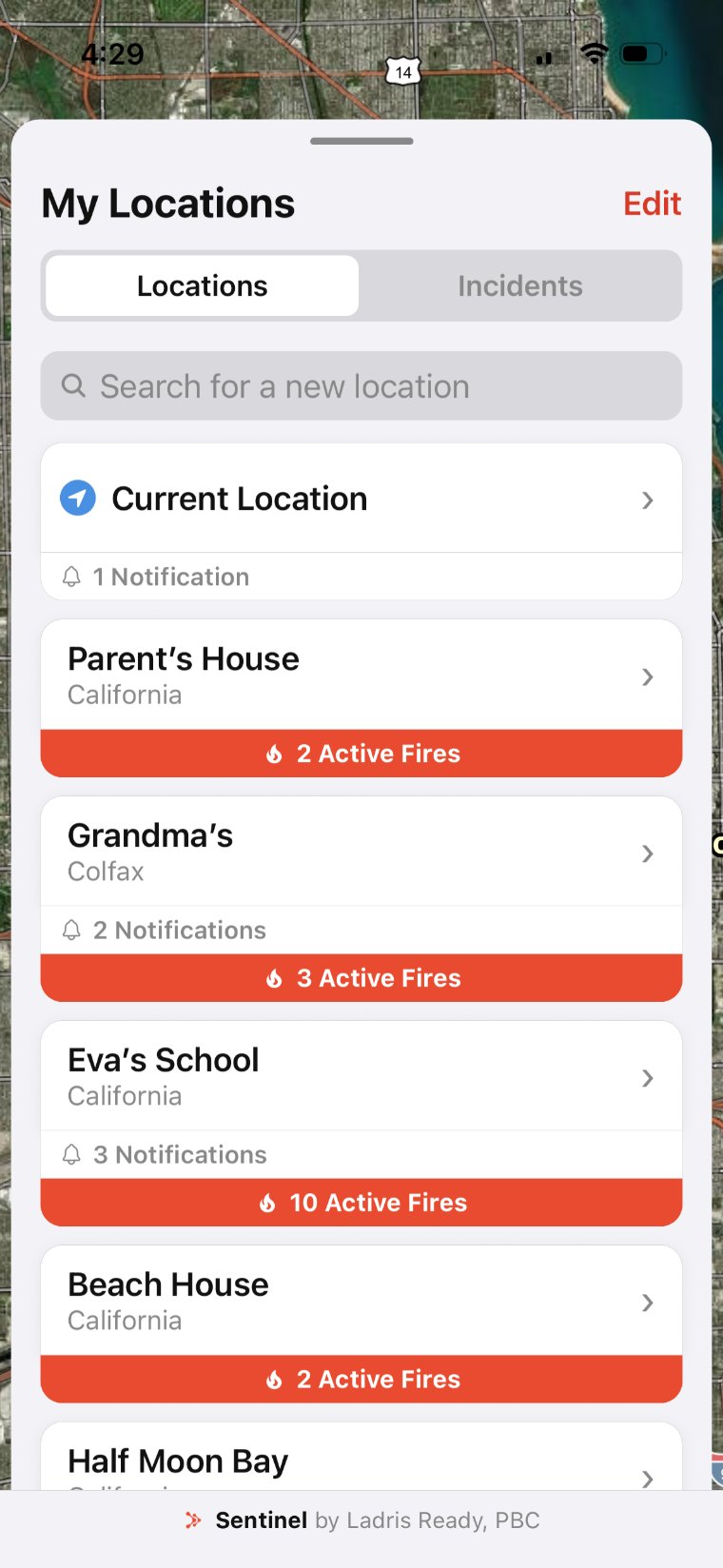
Sentinel My Locations list with saved places named Parent's House, Grandma's, Eva's School, and Beach House, each showing active fire counts
PERSONALIZED

Are my loved ones safe?

Watch your home, your kids' school, and your parents in a different state with unlimited saved locations. For all locations, get notified if a new fire or evacuation starts nearby.

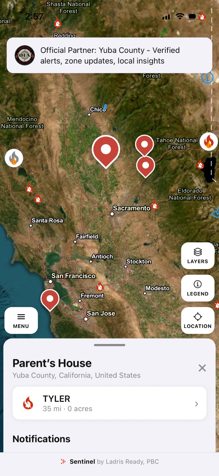
Sentinel incident map over Northern California with a saved location in Yuba County, muted fire markers, and an official partner alert
PRECISE

Is there a fire near me?

Customize notifications for each location to get the ones you care about. Choose to follow an incident and get a push for every update, or silence new fire notifications for any saved location.

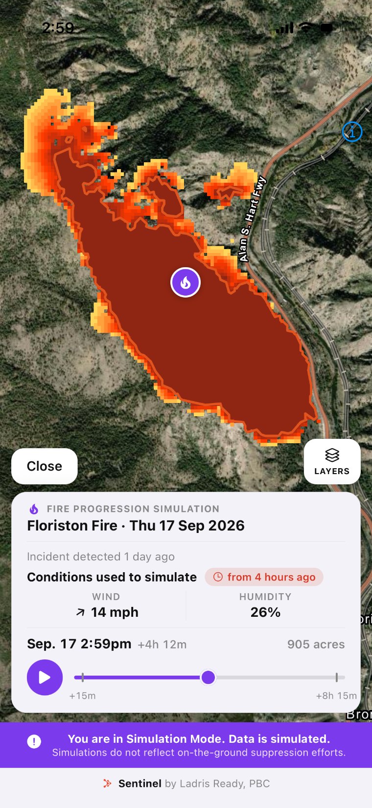
Sentinel fire progression simulation for the Floriston Fire showing predicted spread at 905 acres
PREDICTIVE

How big is this fire?

View fire perimeter estimates even when no official source has a recent perimeter update. Monitor predicted fire spread over 8 hours based on changing environmental conditions.

Could this fire reach my home?

View hour-by-hour predicted spread from the moment a fire ignites, with updated forecasts as the incident evolves.

Sentinel makes Ladris Technologies' proprietary fire spread model available to everyone during active incidents. Early information inspires early action — act now with Sentinel.

  • anywhereWorks for any active fire in the United States.
  • currentUses live weather, wind, terrain, and fuel moisture data.
  • freeForecasts every active fire progression for you, at no cost.

This is a simplified public model built for individual awareness. Partner agencies can access advanced fire modeling through Ladris Core and Ladris Prime.

Founded on a commitment to data accessibility and accuracy.

Sentinel is built by Ladris Ready PBC, a public benefit corporation dedicated to advancing public knowledge and emergency preparedness. We aim to drive a movement toward transparency, helping individuals access information that can guide safer decisions.

Wildfires can cost everything — Sentinel is one step in making sure no one faces them unprepared.

The best time to prepare is now. Install Sentinel today.

All of the information, one app. Free for everyone.